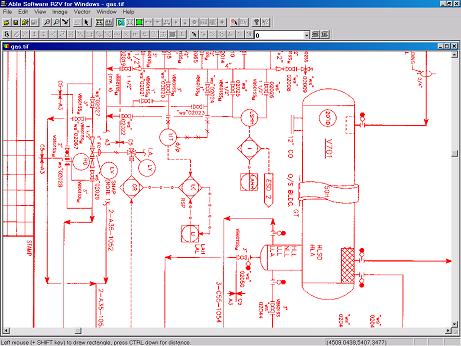
R2V: Advanced Raster to Vector Conversion Software

About R2V    FAQ    Download Demo   Tutorial    User List    Price   Purchase

R2V is currently being used in more than 60 countries by thousands of users for map digitizing, GIS and CAD conversion applications

R2V Applications
Contour Map Digitizing
Parcel/Tax Map Digitizing
Soil Map and Flood Map Digitizing
Mapping from Aerial Photos & Satellite Imagery
Create 3D DEM from Contour Maps
CAD Drawing Conversion
Image Geo-Referencing, Registration & Processing
UTM, Lat/long and State Plane Projection Systems

Download

Download R2V Demo
R2V Output Samples
Image Samples
About R2V
Functions
User List
Frequently Asked Questions
Tutorial
User's Manual 
1-Day Training
Order R2V
Price List 
Order R2V Online
Get Order Form
R2V Resellers and Distributors
Support/Upgrades
Technical Support and Download Upgrades
R2V Release Notes
Register
Company Info
Search
Able Software
email Us
GIS Links


Convert CAD Drawings to Vector CAD Files Automatically

R2V's powerful Auto Vectorize function converts CAD drawings to DXF, IGES, and other formats in just a few seconds.

R2V supports multiple layers exactly the same way as CAD systems do.

R2V can handle very large size drawings.  One major aircraft manufacturer has used R2V to vectorize a 180" by 48" drawing with just a single command. They tried other packages but R2V is the only one that does the job.

If you have a large number of drawings, you can use R2V's batch processing function to process them together with one command.

CAD Drawing


Copyright © 1993-2008 Able Software Corp. All rights reserved.